Lake Powell Hits Record Low
 One of the U.S. West’s most important water reservoirs is about to hit a new low.
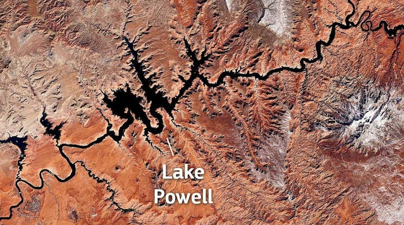
Lake Powell, on the border of Utah and Arizona, is a crucial reservoir along the Colorado River, part of a system that supplies water for 40 million people in multiple states across the West. As of Tuesday, according to readings provided by the U.S. Bureau of Reclamation, the lake stood at 3,526 feet (1,074.73 meters) above sea level, or around 24% of its total capacity. That’s just 1 foot above a threshold of water outlined in drought contingency plans, which would trigger additional releases from upstream water sources. Authorities say that this month, the lake could dip below the 3,525-foot (1,074.2-meter) trigger point, part of a series of new lows the lake has been hitting since reaching its previous lowest level on record, 3,555.09 feet (1083.6 meters), in July. The image above, captured by the European Union’s Copernicus Sentinel-3 satellite in late February, shows the parched Colorado River and Lake Powell from space.